
San Marcos ZIP Code Coverage
Official postal material ties San Marcos to two postal codes: 78666 and 78667. The first is the standard-delivery ZIP for San Marcos. The second is its PO Box and postal-labeling companion. They are the relevant starting points for a San Marcos ZIP code directory, but neither is a map of city limits, a census boundary, or a list of people. Treat the code as an address attribute, then check the property and jurisdiction sources that match the question.
| ZIP | Areas Covered | Post Office | Notes |
|---|---|---|---|
| 78666 | San Marcos standard-delivery addresses | San Marcos Post Office | Primary delivery code; not proof of city-limit location. |
| 78667 | San Marcos PO Box and postal-labeling use | San Marcos Post Office | Companion code; confirm the delivery unit for a specific address. |
The table identifies the postal pair, not neighborhood borders. A letter can carry a San Marcos mailing city while the parcel sits beyond the incorporated line. Conversely, a city address may use a PO Box or a ZIP+4 format. The proper source changes with the question: USPS for delivery, City and Hays maps for physical geography, and property systems for parcel attributes.
San Marcos ZIP Code Pair
The USPS labeling list, effective August 1, 2025, shows 78666 through 78667 with the San Marcos label. The San Marcos Post Office is listed at 900 Bugg Lane, Suite 110A, San Marcos, TX 78666-9807. Use that listing to understand postal naming, then use an address-specific USPS product when delivery service or the proper ZIP+4 must be confirmed.
The image below is the official labeling-list capture used for this postal record.
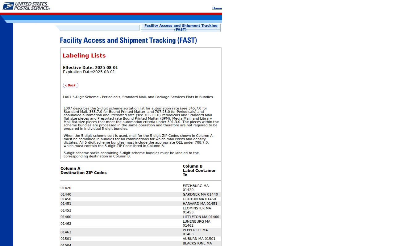
In a ZIP code directory, the label confirms that both codes are associated with San Marcos, while the accompanying delivery context keeps 78666 and 78667 from being treated as interchangeable street-address codes.
Postal labels also do not settle ownership or occupancy. A correct ZIP simply helps avoid searching the wrong locality before a parcel or address record is opened.
Search San Marcos Postal Records
A San Marcos ZIP code directory can narrow a property search, especially when an address is incomplete. The useful result is a set of parcel or tax records, not a household roster. Hays systems can connect a ZIP to an address, owner field, legal description, or tax account. Each result needs a date check and a comparison of situs, or physical, address against its separate mailing address.
- Confirm the ZIP for the complete address using USPS material, especially when a PO Box or rural-style address is involved.
- Open Hays County Tax Advanced Search and combine City or Zip Code with a property field when the result set is broad.
- Record the property ID, situs address, legal description, and tax year from a matching result rather than assuming every record in the ZIP concerns the same place.
- Check the parcel location in Hays County GIS or the City map when the physical location or emergency address matters.
- Use a verified street address for the detailed street-by-street chain. The San Marcos street directory follows that narrower address route.
The Hays voter lookup is different. It requires an exact first and last name plus date of birth, or a 10-digit VUID plus date of birth, and it does not offer a casual browse of a ZIP or block. That identity gate prevents a ZIP filter from becoming a substitute for the official election process.
San Marcos Tax ZIP Fields
The Hays tax search is the local portal with a direct Zip Code control. It also accepts property and owner-related fields, so a ZIP can be combined with a more precise property question. Use it to find property records in a postal area, not to draw conclusions about every person who may be present there.
| Field | How It Helps | Search Boundary |
|---|---|---|
| City | Limits results to a named postal or municipal locality field. | City text is not a city-limit ruling. |
| Zip Code | Narrows tax-property records to a postal area. | It is a filter, not a resident list. |
| Street number and name | Focuses a search on a particular address. | Use street-name variants where records differ. |
| Neighborhood, subdivision, block, tract or lot | Connects a parcel to its legal or mapped setting. | Match against the parcel record before relying on it. |
| Property status and tax year | Places a result in a defined tax context. | Current-year values can change. |
The Hays public parcel layer documents the field structure that supports this cross-check.
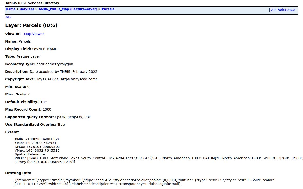
The parcel-layer capture shows that ZIP is one attribute among address, ownership, legal-description, and tax fields. It should be read with those fields, not alone.
San Marcos Parcel ZIP Fields
Parcel data makes an important distinction within a San Marcos postal-area search. The layer exposes both a situs ZIP and a mailing ZIP. “Situs” means the physical location of the parcel. A mailing address can be elsewhere, so it may point to a different ZIP even when the property itself is in the San Marcos postal area. The same layer exposes owner name, legal description, physical address, tax year, and year built. Those fields establish record context, not current occupancy or certified title.
| Parcel Field | What It Represents |
|---|---|
| SITUS_ZIP | ZIP attached to the parcel’s physical address. |
| MAIL_ZIP | ZIP attached to the recorded mailing address. |
| SITUS_ADDR and SITUS_CITY | Physical-address fields that should be read with the ZIP. |
| LEGAL_DESC | Legal description used to distinguish similarly addressed property. |
| OWNER_NAME | Recorded owner field, not an assertion of who occupies the parcel. |
The published layer is polygon geometry, with data acquired by TNRIS in February 2022 and a listed last edit of December 22, 2025. Its technical service has a 1,000-record maximum. Those metadata dates matter when comparing a map result with a newly changed address or tax record.
San Marcos ZIP Boundaries
Postal codes and San Marcos city limits are different shapes. A postal city can cover an edge or rural address outside the city, while a city-limit address can have a delivery detail that does not look like a simple street ZIP. The City of San Marcos interactive maps are the local starting point for city limits and ETJ context. For delivery, keep USPS as the authority. For a parcel’s jurisdiction, compare City and Hays GIS data.
- ZIP
- A postal code used to route and label mail. It is not an incorporated-boundary line.
- ZIP+4
- An added four-digit delivery detail used with a postal code for a more specific mailing segment.
- PO Box ZIP
- A code used for post-office-box service; it does not describe a home or parcel boundary.
- Carrier route
- A postal delivery grouping. It is useful for mail operations but is not a municipal geography.
The Census calls its generalized ZIP-based areas ZCTAs. Its ZCTA guidance makes clear that those statistical areas are not USPS delivery routes. A ZCTA number is therefore not a replacement for a postal lookup, city limit, or parcel boundary.
San Marcos ZIP Address Systems
When a mailing label and a mapped location seem to disagree, compare several address systems in order. City GIS provides interactive maps, PDFs, shapefiles, and an address-lookup path. Hays GIS and 911 addressing use roads, address points, and aerial data and assign 911 addresses for most of the county. Hays GIS can be reached at 512-393-2160 or 512-393-2150, option 6; City planning lists 512-393-8230.
A needed map dataset that is not posted can be requested through the applicable public-information process. The location check should stay specific: identify the street, number, municipality question, and approximate date. A broad request for every address in a ZIP is less useful than an address-specific comparison.
Note: A San Marcos postal label can coexist with an unincorporated or ETJ location, so postal delivery and emergency addressing should be checked separately.
San Marcos ZIP Edge Cases
Nearby Hays County ZIPs should not be folded into a San Marcos ZIP code directory without an address-specific official result. The inspected postal material did not assign 78668 to San Marcos. It also did not identify 78669 as San Marcos. ZIP 78655 belongs to a Martindale or other regional delivery context, and 78640 is associated with the Kyle and Buda area. Proximity on a road map is not enough to change a postal designation.
These edge cases matter when a property search returns an adjacent community. Keep the ZIP shown in the source, then compare the situs city, mailing city, and parcel geography. A mailing city is a delivery convention; it should not be silently rewritten into a claim about the incorporated city.
San Marcos ZIP Geography
The city’s ETJ generally reaches 3.5 miles where another city’s limits or ETJ does not intervene. Agreements with Kyle, New Braunfels, and Uhland make the simple radius less decisive at the edges. This is a useful geography check because an address can be close to San Marcos, use a familiar postal label, and still fall under a different municipal arrangement.
For a current address question, retain the full address, the date checked, the ZIP shown by USPS, and the map source used. For an older address, add street-name variants and the legal description when available. That small record trail makes a later correction possible without turning a postal label into a claim it cannot support.